Thursday, April 13, 2017

Mt Toll Ski Outing

4/12/17
Mt Toll is one of the sharp peaks on the Continental Divide west of Brainard Lake near Ward CO.  Classic spring ski descent.  More details can be seen at the Front Range SkiMo page here - http://www.frontrangeskimo.com/toll/ I've done this one several times, always a good long day.

Sometimes I write these up as much as a reminder for me for future outings.  Things that went well, things that could have been done better.  I started at the Winter closure at 7am.  Usually I bring a mountain bike to use on the paved road to the trailhead.  Sometimes, there's a little hike-bike this time of year.  This year, the bike was a total waste of time.  So much snow.  Friends had skied here 4 weeks ago and said, don't bring a bike.  I thought, 4 weeks, should have had some good melt-out by now.  Good melting, but not enough.  The mt bike was abandoned after 1/2 mile.  A fatty would have been better on the frozen snow,  but all that snow would super soft by the afternoon. This will make for a longer outing I guess.


Tools for the day.

Buried Visitor Center at Brainard Lake Summer Parking Lot, Mt Toll is triangular peak left of center, 12,979ft
Giving into a long approach skin, one has time to think, listen and observe. The Winter transition is underway.  Song birds are flitting around.  Woodpeckers are doing their work. Streams are just starting to open up.

One of the interesting things about this ski, is you can always see Mt Toll.  Gradually, it comes closer and closer till the final headwall.  So, close, right? Still another hour to the top.

Mt Toll, ski line is left shoulder.
The Divide was socked in under a storm for a few days a few days back.  What's the snowpack looking like?  Below treeline, pretty spring-like, above tree-line more and more Wintery.  The final push up the summit grade, was very winterlike with knee-deep post holing.  Moving to the rocky saddle and ridge was much faster.  Think it needs a few more weeks of freeze / thaw to consolidate.

Once on top, the views are fantastic, the wind dies and it's very pleasant.

The jagged West side of the Divide behind Pawnee Peak. Big lines abound.

Westward panorama.
Time for the descent.  Not sure how stable the snowpack was, I chose to keep far skiers right near the rock.  Should anything go, I felt I had a safe exit.  Jump turning in winter snow with a skin of wet snow on top was work.  Down at the lower slopes, the snow transition to hero corn snow and the glide to treeline was fabulous.

Wiggle is near rocks.


Below treeline the snow got heavier and wetter.  Skiing through the tree shadows was a precarious balancing act as the snow in the sun was extremely wet and slow while the snow in the shadows was not as wet and faster.  It was a game of push me pull me back to the road. The final ski out the road was relatively quick, picked up the Mt Bike and pushed / rode it out the last half mile.  Always enjoy the looks and questions on hikes seeing this person coming out with all this stuff.

Over-all, 7 hours over 14 miles, ~3k vertical feet.

Thursday, April 6, 2017

The Grand Traverse, The Real Deal

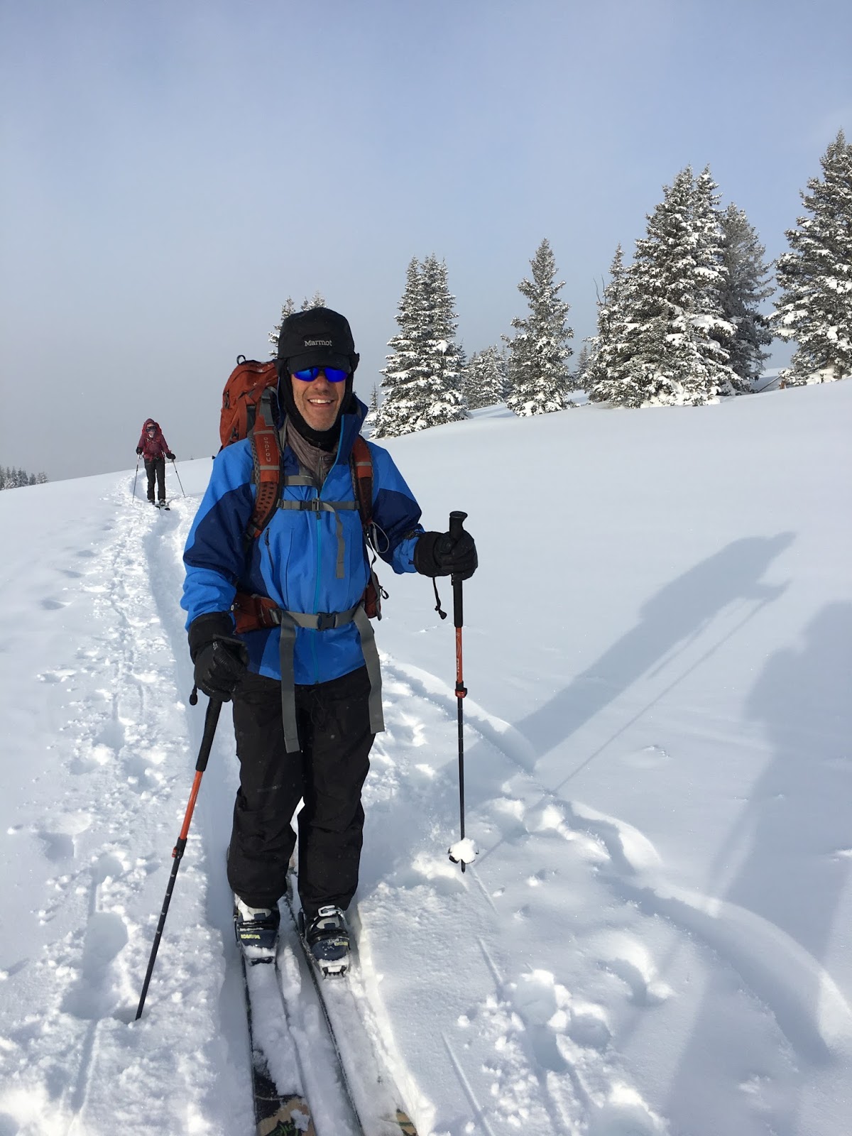
Warning. Not much on the picture front, hey we were racing.

The Grand Traverse is a ski mountaineering race from Crested Butte to Aspen. Forty miles and about 7,000 vertical feet across the Elk Mountains. In 2017, it's celebrating it's 20th anniversary. As SkiMo races go, it's longer, less vertical and considered a bit of a sufferfest.  Here's a link to the event website with some history, stats and pics.

https://www.facebook.com/grandtraverse/

Training consisted of long days on the weekends (see previous blogs http://kubeadventuresinc.blogspot.com/2017/03/grand-traverse-training-longs-peak-via.html) and some shorter weekday outings.  Was it enough?

Springtime in the Rockies is very unpredictable.  Warm temps and spring snowpack?  Cold temps and deep powder? That outcome will decide the course and destination of the "Traverse." Previous years have had winter storms and the race "Reversed" not getting to Aspen. What will this year bring?  Early forecasts called for storms, everyone whispered about another Reverse.

The race begins at midnight Sat morning and ends sometime Saturday in Aspen.  With this timeline, Friday turns into sort of an odd day.  Racer briefing mid day Friday reveals that the promoters are happy with the forecast and snowpack and so we are heading to Aspen. One of the race's peculiarities is that there's a fairly extensive required gear list and mandatory gear check.  Once through this, it's time to pack, re-pack, re-pack again, try and nap, eat and wait for midnight.

The race starts at the base of Crested Butte Ski Area with a festival atmosphere. Once the gun goes off,  all 400+ of us start a rapid skin pace up the mountain. Trying to stay with your partner at this point, is not really possible. Pavla and I set a plan to try and connect on the top of the ski area and if not possible, on the back side at the base of the ski area boundary. Pavla and I actually stayed fairly close to each other to the top, but got separated on the icey "Dark Blue" Indian Trail Ski run.  To summarize the ride down, a racer fell near Pavla and slid down most of the run, unable to stop. Nothing like a stiff cup of coffee after midnight to wake-up!

The backcountry experience starts after the icey descent with a long side traverse to the mouth of Brush Creek drainage.  Along the way, there are several ski off boot packing efforts due to lack of snow coverage or too steep ascents out of "elk wallows."  I found it amusing, other's cursed under their breath.  It was during one of these efforts that Pavla called out, "My boots are broken!"  What?  New LaSportiva Cyborg boots, maybe seven outings, but sure enough she pulled up and the instep buckle straps had snapped in the middle of both boots.  Damn, are we done? Perhaps not, we have grey tape. Indeed, just enough grey tape to wrap around boots were strap once was.  Will it hold for the next 25-ish miles? The next obstacle was that Pavla's rental ski Dynafit TLT Superlite bindings refused to lock into tour mode. Sort of important, since they just release when in ski mode due to side loading. After much fussing, it turns out the pins were maybe a little long or Her ski boots a little wide, or a bit of both, but the detents in the boots had to be absolutely free of mud ice or snow or they wouldn't lock. So we had a little ritual at every boot pack / ski transition where I got down and cleaned out the detents with an awl tool and she could lock in.  Lot's of time lost, let's see what we can do to make up time.

The next segment of the race is a long grind up (~2.5kft vertical climb) to Friends hut and mandatory checkpoint. We seemed to be among slower skiers, but it's a single track so passing needed to be timed when there was maybe a side track.  The passing went some thing like this.  "Pavla? Are you there?"  "Yes" "Are you ready?" either "Yes" or "Not yet." If "Yes" we'd accelerate around the string of skiers and step back into the track looking for the next set to pass.  It's pretty difficult to gauge where we were relative to the masses, so we just kept this up till we reached Friends hut. 5:30 am, get some fluids, eat, head up Star Pass.

Star Pass, elevation ~12,400ft, was not to be skinned up this year.  Hard snow / ice turned it into a boot packing climb.  Once in the "line" there was no passing to be done as stepping to the side meant a potential slippery fall on smooth hard snow.  Stay in line.  Dropping off of Star Pass was just that.  Dropping off a cornice into pretty steep terrain.  Not the place to take a tumble. There was another mandatory check point at the base of the Star Pass descent, Geo's Bonfire. Sunrise.

Morning light on Star Peak.

Early morning light was uplifting. Time to turn off the headlamps.

Pavla (R) happy for a little break and some coffee. Communal cup.


Somewhere around halfway at this point.  Legs feeling ok.  Time for a big climb back up to Taylor Pass / Peak, 12,400ft.  Things have pretty well spread out at this point.  We seemed to be moving a little faster than those around us, still passing folks.  This is a long section of the course.  Lot's of time above treeline, beautiful views of the Elks Mountains, wind packed snow.  At the Taylor Pass check point we hear, 5 miles to final checkpoint, then 7 miles from there to Aspen.  Damn, we're getting there.

Our pace started to slow going into Barnard Hut checkpoint.  The aid station people laughed about how people enjoyed lounging there perhaps a little too much.  The ramen was tasty.  The drinks very liquidy. 10 am, think we could be in Aspen by noon.

Alright, seven-ish miles along Richmond Ridge.  A section one of the promoters commented was used by evil Russian coaches to test their athlete's ability to withstand suffering.  It held true to this description.  Snow warmed and softened.  Sticking to skins.  Fatigue sets in.  Pavla bonks.  Bad.

To those that have bonked or been with someone who has bonked.  It's not a pretty sight. Motivation evaporates.  Tempers may flair. "I just want to be home!"  Strategies to get someone through this vary: Browbeat - "Dammit why did you eat?" usually don't  work so well unless this is the last outing you want to do with said partner. Silence and get them home, break the wind / break trail strategy can work, but they are going through their own inner Hell that if you've ever been there is like multiple root canals.  Or, you can distract your partner with tales of childhood pets.  Cats, hamsters, poodles, horses, etc. etc.  If you want to do something again with this partner or have to wake up with said partner, I suggest option three. You never know when it might be your turn.

In the end we reached the top of Aspen Mountain (Ajax) after a 3 hour traverse and all that was left was a 3kft descent to the finish line. The Russian coach analogy lived up to it's name. We dropped in and skied the last stretch with pauses to let the jelly legs recover a bit.  At the finish line, just under 14 hours from the start, was one of the race stalwarts who greeted us with a hug and finishing metals and a trail running friend, Deb Luther, who helped us navigate foot repair, food, pitstops while she waited for friends to finish.

My second GT race. Would I do it again? Perhaps with the right reason.


Tuesday, March 28, 2017

Grand Traverse Training - Longs Peak via Keplingers Couloir

I had done one of the early Grand Traverse Races (40 mile Ski Mountaineering race from Crested Butte CO to Aspen CO).  I decided enough time had elapsed and memories had faded sufficiently it was time to sign up again.  This time as a co-ed team.

My partner was a little behind getting her winter game on so we decided to throw in some bigger days to "accelerate" the training.  What better way to have a big, tough day than a Winter ascent of Longs Peak.  I've been up Longs in the Winter on all aspects except the south face, so the time seemed right to give Keplingers Couloir a go since the weather had been conducive for a Winter climb.  What's that mean?  Keplingers is a plumb Spring ski decent that can be skied from the summit (14,250 ft) in good years.  In the Winter, it's typically lean on snow and can have avalanche exposure with new snow / wind.  It had been a while since the upper peaks had seen snow and winds had been high (100-120 MPH) on the mountain tops.  This typically scours new snow and compresses snow into "styrafoam" conditions. This makes for good climbing conditions, maybe not so good ski conditions, but this was about getting out, getting some miles (17-ish) and some vertical (~6k ft).

Since it's Winter, a 3 am alpine start isn't necessary.  No thunderstorms now.  At least, I hope not. Leaving Boulder before dawn was a 5:30am beginning.


This Winter had a great January start then tapered off, significantly. This might mean a wee bit of a walk at the start. Not such a big deal on the front end, however, a bit of a pain on the back end. Always chipper at the start.


Keplingers is one of Longs Peak longer approaches. It crosses under the south face of the Dragon's Egg Couloir off Mt Meeker. Not such an interesting ski, yet. Hopefully the spring snows will fill it in.

Mt Meeker and Dragon's Egg Couloir


While it's a long slog in, it's amazing to pass by the glacial erosion and deposits.


Luckily, there are great views of Keplingers Couloir from the lower valley.
Longs Peak summit in center, Keplingers Couloir winds up from base towards the Notch then traverses left towards the Summer Home Stretch finish.

Lower portion of Keplingers Couloir, Sand Beach Lake in the background.

In the gut of the Couloir.  Not exactly ski conditions.


Finally on top, windy, as usual, but not too bad for Winter.

The summit is such a strange place, and that's not any reference to the visitors.

Back down to the base of the Couloir as the sun sets on the higher ridges.  Time for headlamps.

This was after-all a training exercise, and we got what we asked for.  Headlamps on at 12k ft with a sketchy, icy ski out to the final miles where it was skis on packs for the final walk out.  All in all, 14 hours, 17 miles, 6k ft vertical and a good day in the mountains.


Thursday, March 2, 2017

Skiing the Ring of Fire

Using this post as a planning forum for skiing some of the Pacific North West Volcanoes in the Spring of 2017. Inspiration came from a book gift from a very dear friend.

Resources:
http://www.skimountaineer.com/CascadeSki/CascadeSki.html


Basic plan:

Tentatively planning on two weeks: 4/22/17 - 5/5/17

Friday 4/21/17

Fly into Portland, OR in the morning, out of Seattle, WA
Inbound ~$200, Outbound ~$200
Rent SUV ~$500
Gear up, rental ski stuff?
Lauren and Jenna join
Timberline Lodge - ~$105 / night / room
Portland - Timberline Lodge Drive Time ~1.5 - 2 hrs
Need permit and poop bag!
https://www.fs.usda.gov/main/mthood/passes-permits


Saturday 4/22/17 - Mt Hood
Old Crater Route or Pearly Gates Rout on S Face
8-9 miles, 5280 vertical feet
Plan on 5-7 hrs for ascent, 1 - 1.5 hrs for descent
4-5am start? Sunrise 6:13am Be on top 9-10am depending on weather / temps
Drive back to Portland afterwards

https://en.wikipedia.org/wiki/Mount_Hood
http://www.skimountaineer.com/CascadeSki/CascadeSki.php?name=Hood

My experience - Climbed this previously in both traditional season and Winter season.


Monday 4/24/17 - Mt St Helens
Portland - Mt St Helens - 3 hrs
Worm Holes Route
12 miles, 5500 vertical feet
Plan on 6-8hrs ascent, 2 hrs descent
Park at Marble Mt Snowpark
Permit required:
https://www.fs.usda.gov/detail/giffordpinchot/passes-permits/?cid=stelprdb5145230
Drive to Trout Lake, WA ~2hrs


https://en.wikipedia.org/wiki/Mount_St._Helens
http://www.skimountaineer.com/CascadeSki/CascadeSki.php?name=StHelens

Tuesday 4/25/17, Wednesday 4/26/17 - Mt Adams (12,276 ft) 
Lodging:
https://www.kayak.com/hotels/Trout-Lake,WA-c19645/2017-04-24/2017-04-26/2guests

Tuesday sort / dry gear, prep for Wed Climb
Southwest Chutes
14 miles, 7000 vertical feet
Plan on 10-12 hrs
Permits and South Climb Parking
https://www.fs.usda.gov/recarea/giffordpinchot/recarea/?recid=32138


https://en.wikipedia.org/wiki/Mount_Adams_(Washington)
http://www.skimountaineer.com/CascadeSki/CascadeSki.php?name=Adams
Lou's Route Report
https://www.wildsnow.com/7752/adams-mount-washington-skiing-climb/


Thursday 4/27/17, Friday 4/28/17, Saturday 4/29/17 Mt Rainier ()
https://en.wikipedia.org/wiki/Mount_Rainier
http://www.skimountaineer.com/CascadeSki/CascadeSki.php?name=Rainier
Fuhrer Finger

Climbed this a few times from multiple routes and various seasons


Sunday 4/30/17,  Monday 5/1/17, Tuesday 5/2/17 Mt Baker ()

https://en.wikipedia.org/wiki/Mount_Baker
http://www.skimountaineer.com/CascadeSki/CascadeSki.php?name=Baker


Tuesday, January 31, 2017

Bene 100


The Benedict 100, or Bene 100, is an approximately 100 mile ski tour from Aspen to Vail that traverses the heart of Colorado's central Rockies while climbing close to 20,000 ft vertical.  The tour runs 6 days and connects five of the 10th Mountain Division Huts. The tour honors 10th Mountain Division veteran and hut system founder, Fritz Benedict.  The following is a stylized map, a more detailed map can be found at: http://paragonguides.com/winter-hut-route-map/

General Benedict 100 route and Huts used.
This tour ran from Jan. 22 - 27, 2017.  Snowpack and weather are always major factors for a tour such as this.  The 2016 - 2017 Winter got a late start with lot's of hand wringing. However, things got started with a bang during early December and by the first of 2017, most of Colorado was reporting 150 - 200% of normal snowpack.  Nice recovery!  Approaching the start of the Bene 100, the weather looked to deliver pretty regular doses of snow. Not a snowpocalypse, but one never knows, weather is fickle in CO.

The tour was coordinated by Paragon Guides out of Edwards, CO.  They have a special arrangement with the 10th Mountain Division Huts organization to book the necessary huts across the tour. Without this arrangement, the tour would essentially be impossible as getting the necessary hut reservations through the open market is next to impossible.

The group consisted of nine clients and three guides.  I was joined by longtime friend, Foon Feldman.  The other members included two gents from Baltimore, one gent from Manhattan, a gent from Colorado Springs,  a gent from Arvada and a couple from Evergreen.  As for telling this story, I'm going to simply lay out a chronological story with a mix of my photos and some from the group.

Day 1 Aspen to Margy's Hut, 13 miles / 3600ft

After a restless night's sleep thinking about logistics, weather, packing list, etc., the alarm goes off at 3:30am. Let's get this party started!  The forecast held true, snowing pretty hard.  By the time we reach the trailhead in Aspen, at 7am, there was 1-1.5ft of fresh on the ground.  Looks like we'll be breaking trail. BTY a central theme for the Tour.


Troops gliding through N Hunter Creek upper meadows en route to McNamara Hut lunch stop.  Several Fourteeners peaking out through the thinning clouds in the distance


Ribbon cut through dense snow covered forest near McNamara Hut.

Lunch stop at McNamara Hut, the first 10th Mountain Division Hut built in 1982.
The day was described as the toughest of the Tour.  Hmm, but what about big day 3, Uncle Bud's to Jackal?  In the end, each day was a pretty big day.  After 8hrs of skiing, we reached Margy's Hut.  In a major snowstorm.

A buried Margy's Hut the following morning. Damn fine Winter so far.
Guide Will (L), Hut Hosts Bryan and Sara.  So nice to show up after eight hours of skiing and have someone hand you a hot cup of tea with appetizers and dinner right behind.


Day 2 Margy's Hut to Betty Bear Hut, 18 miles, 2500ft Vertical

As shown in the above picture and below, the day started in a solid snowstorm and, well, that's pretty much how the whole day went.

Troops marching out first thing in the morning after a solid breakfast.

Day 2 was typical of some winter outings, things didn't go as expected, there was some wandering around in the woods, we had to slowly break trail going downhill, it was longer than planned, it ended with headlamps for the last four hours, it broke some people. Since it was a day of focus, there's not a lot of pictures.
Extended break under a fully loaded private cabin's front porch near Nast.  Don't sneeze!
About 2/3 of the way through the day, 3 clients decided they were done and were escorted down valley to another Hut and eventual exit.  Tough decision for clients and guides alike.  How far to push without threatening the whole group?  No judgement, it's a tough call.  One guide down, I was asked to assist with the lead group, route finding and trail breaking to Betty Bear hut.  As darkness fell, the snow knob was turned up. A lot.

The final leg of the route wound up Road 505 to the final 2,000ft climb to Betty Bear.  Spindrift avalanches fell off the road cuts along the way.  Nervous backcountry travel.  Finally at the trailhead, nerves settled down as it was steep trail breaking, blue diamond searches in a safe dense forest. After several false Hut sightings, I was never so glad to to see Hut Hosts starting out from the Hut to search out the long overdue team.  After 12-13 hrs on the trail, all were glad to be "home."

Nick(L) and Alex(R) Hut hosts offering up their culinary expertise.
Day 3 Betty Bear to Uncle Bud's Hut, 11 miles / 3,000 ft vertical

After a night of heavy snowfall, the day started with, guess what, trail breaking.  The route climbed up to the Continental Divide at Hagerman Pass near Skinner Hut and the dropped down to Turquoise Lake then climbs up to the road high point then eventually to Uncle Bud's Hut.

Guide Will in diesel mode, breaking trail up to Hagerman Pass.

Mark traversing Hagerman Pass in fairly good visibility, for now.

Mark standing on top of America.

I made it up there too. Jolly Green whatever.  All that green was just a coincidence.  Really.
Guide Will coming down East side of Pass in worsening conditions.
 Weather in the mountains changes quickly.  In the short time between the first skiers crossed the Pass and the rest of the group came across, things went from pretty good visibility to white-out conditions.  Good to get down in the forest.

The ski down from Hagerman is quite pleasant.  Along the way we met a group of 20 Army soldiers snowshoeing in.  Not sure if this was an official exercise or just a relaxing outing. After a nice slide out, it's a longish three mile, 1000 ft,  climb to the high point on north shore road.

Uncle Bud's reception!

Ted and JT Hut Hosts.  Great food and conversation.


Day 4 Uncle Bud's Hut to Jackal Hut, 18-20 miles / 3500 ft vertical


This was supposed too be the big day.   Longer miles and more vertical climb. Somehow, after the previous days everyone was like, "OK, bring it"
Winter wonderland.

OK give me the phone/camera.

Guide Rochelle cranking up the hill.

Pumpkin patrol.

Leaving the Holy Cross Wilderness.

It's a good Winter when the trailhead signs are below our feet.

Traipsing along.

10th Mountain Division downhill ski training grounds  = B Slope. We had to do this.

South Camp Hale snow machine adventures. Or not.

Guide Will, sporting a beardcicle before the climb to Jackal Hut

Encouragement from Greg (Paragon Guides) en route to Jackal Hut.

Foon enjoying another day in the mountains.


Will, Mark, Mike heading up to Jackal Hut.


Amazing Hut Hosts Lucas (L), Jess (C) and Dave (R). Best meal on the trip!

Oh, yeah, third trip to Jackal this Winter.
 While it was the longest day of the tour and temps stayed sub zero for most of the day, it was relatively uneventful leg.  All were glad to get to the Hut and enjoy an amazing meal.


Day 5 Jackal Hut to Shrine Mountain Inn, 15 miles / 2700ft vertical

There are two options to get between Jackal Hut and Shrine Mountain Inn. The lower route when weather is acting up and the high route (sometimes called Tim's Route) up and over Pearl Peak down through Searle's Pass.  Despite a -10F starting temp, the winds were calm and the day was clear.  Up and over we went.

Cold, crisp morning heading out from Jackal Hut.


Ken popping out above treeline.  His comments "That alpine traverse was one of the coolest things I've done!"

Rochelle keeping things covered up.

Faint Sundog and a trail that needs breaking, again.

Jackal Hut sits at the upper edge of the open area on the peak below.

Partial track up to Pearl Peak.

Foon sporting a beardcicle as well.

When snow patterns match cloud patterns.

The troops making their way up Pearl Peak. Trying to stay warm.

Jackal is just a little farther away.

Looks like some creature from Cirque du Soleil.


Dropping out of Searle's Pass to Janet's Cabin for a little warm-up and nourishment break.
 After a welcome warm-up at Janet's Cabin, the group traversed over to Shrine Mountain Inn.  A longer ski than I expected, but enjoyable trek right at treeline.  Once again, we were greeted by generous hosts and warm drinks.

Frosty troops with smiles after completing another day on the trail.

Will continues to excel at the beardcicle competition.  Mine just looks like more grey.

Hosts Shauna and D-Bone.
Shrine Mountain Hut - Jay's.
Day 6 Shrine Mountain Inn to Vail via Commando Run, 14 miles / 2000ft vertical

This is it.  The last day. Mixed emotions among the group.  Some glad to wrap it up.  Ready for a little down time.  Me, I could do this for a long time.  Love the pattern of rise, eat, ski, stop eat sleep.  Simple life.  Much like backpacking, climbing big peaks.

The day started cold again, -5F, but clear and calm.  Surprising how warm things can "feel" when the sun is out.  Today's route is essentially the Commando Run, a favorite day tour that traverses from Vail Pass to Vail ski area.  The best part of the day is the views from Top of the World.

Will approaching Top of the World.

The crew with the Gore Range as a backdrop.


Gore Range, I-70 is in the valley below.

The final climb, seriously, that's the last climb?  Up Siberia Peak before dropping into Mushroom Bowl and into Vail Resort.

Final meal together.  Goulash and beers at Pepe's.  
Final thoughts?

  • I made some good friends.
  • This tour ranks up there with some of my best adventures.
  • It's not a trivial outing.  Most days were 8-12 hours long. Be prepared to put in your best effort day after day.
  • I used SkiMo gear (Atomic Ultimate 65 skis (163cm long, 97 - 65 - 80cm profile, Hagan ZR bindings, Scarpa Alien Boots) and was pretty happy with that choice.  If I had to do it again (which I might) I'd use a little longer fatter ski as some days I was wallowing in powder breaking trail or descending.  A little more floatation would've been nice at times.
  • As we had scrumptious dinners and breakfasts at the huts, we were responsible for trail food.  I planned for 2000 kcal on the trail and was religious about using Skratch in my 2 1L water bottles. It seemed to work for me.